Land North of Queens Mead
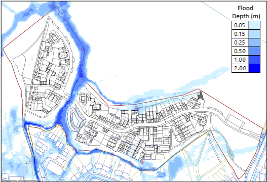
As the development site exceeded 1 hectare and was considered “major development” the planning application required a Flood Risk Assessment (FRA) and Sustainable Drainage Systems (SuDS) strategy to demonstrate that the development conforms to local and national planning policy requirements and guidelines.
Client: Shanly Homes
Status: Planning permission granted
Services
Flood Risk Services
- Flood Risk Assessment (FRA)
- Sustainable Drainage Strategy
- Flood Defence (Mitigation) Strategy
- Flood Investigation
- Hydrology & Hydraulic Modelling
- Flood Emergency Plan
- Basement Impact Assessment (BIA)
- Groundwater Flooding
- Expert Witness
Environmental Services
- Nutrient Neutrality
- Flow & Water Quality Monitoring & Sampling
- River Geomorphological Survey & Assessment
- Water Framework Directive (WFD) Assessment
- Water Resources Assessment
- Environmental Impact Assessment (EIA)
- Air Quality Assessment (AQA)
- Catchment Management Plans
- Environmental Permits, Licences & Consents
- Expert Witness
Engineering Services
- Sewerage Design
- Sustainable Drainage Systems (SuDS) Design
- Landscape Amenity & Sport Facility Drainage
- Earthworks Design
- River Design
- Roads & Driveways
- Expert Witness
Project details
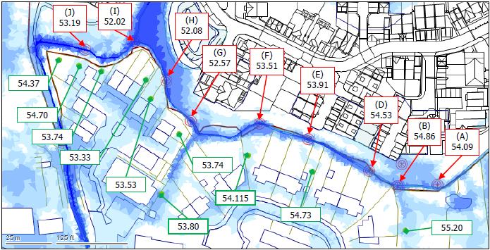
The FRA identified that whilst the application site is shown to lie in Flood Zone 1, there is a surface water flood risk associated with the ditch along the southern site boundary as well as flowing through the site.
Site specific surface water hydraulic modelling was undertaken as part of the FRA to define surface water flood extents and levels for setting development boundaries and minimum threshold levels for individual dwellings. The modelling was also used to inform the design of the proposed surface water drainage pond.
The development of the SuDS strategy for the site was complicated due to the significant sloping topography, the exclusion areas defined by the catchment surface water flooding, and the requirements from Surrey County Council (as the Lead Local Flood Authority), who sought the maximisation of the use of open storage and swale drainage.
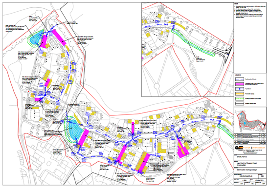
Water Environment Ltd designed preliminary road and site levels for the proposed development using Site3D to determine the appropriate drainage strategy and confirm that a gravity stormwater drainage network could be achieved.